Experience level – med. high – three 1.5km thick scrub sections, and some tricky route finding offtrack and where tracks are overgrown.
Be sure you start walking offtrack sections from the right point. Ability to interpret detailed trip notes and GPS route provided - essential. EPIRB or PLB essential. Route files: Newnes_Plateau_Circuit.kml or Newnes_Plateau_Circuit.gpx
Don't forget to check NPWS alerts for the Gardens of Stone SCA before you head out.
Distance: 69km; with an ascent of 2.2km.
Map Sheets1:25,000 - Wollangambe, Lithgow and Cullen Bullen. By using access roads, this circuit walk can be sliced into one-, two- or three-day sections.
Water: there’s good water, but not all camps have water, so you’ll need a 3-4 litre water bladder.
Parts of the route follows closed management roads, so the offtrack sections are balanced with sections where the route is straightforward. Another advantage of this route is you can “bail out” at various points on the Plateau, hitch or walk back to Lithgow, or call a friend to come and get you. Mobile coverage is patchy on the Plateau and non-existent in the valleys and gorges.
This trip through Gardens of Stone State Conservation Area gets right amongst pagoda landscapes, swamps and streams of Newnes Plateau. You start from Bell Station and finish at Zig Zag Station or Lithgow Station, so leave the car at home, that way relaxation starts when you board the train…
Traversing the Plateau, you will cross the Wollgangambe and Wolgan Rivers, and Bungleboori, Dingo, Carne creeks, and traverse Lambs, Kangaroo, Marangaroo and Farmers creeks. Each valley is different and each has its challenges. This trip offers plenty of variety - there 's not another 4-6 day walk in the Mountains that visits so many creeks and rivers. To do it in 4 days, you'll have to walk all day and be sharp at route navigation.
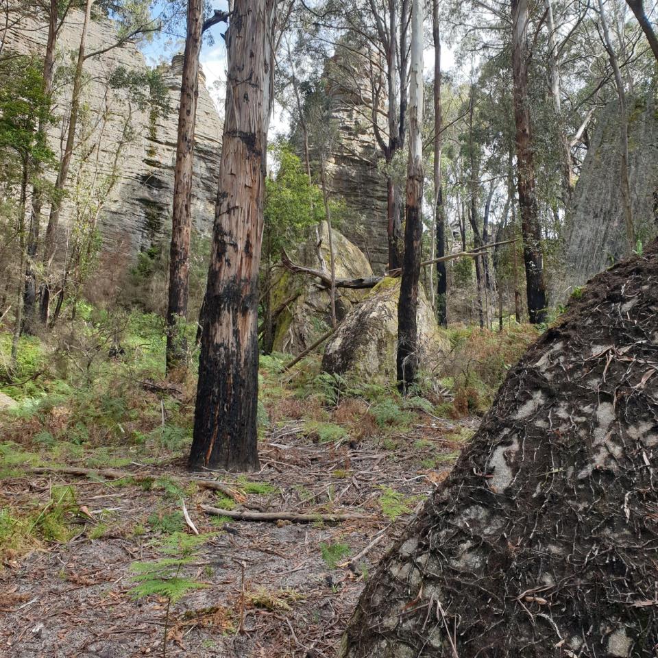
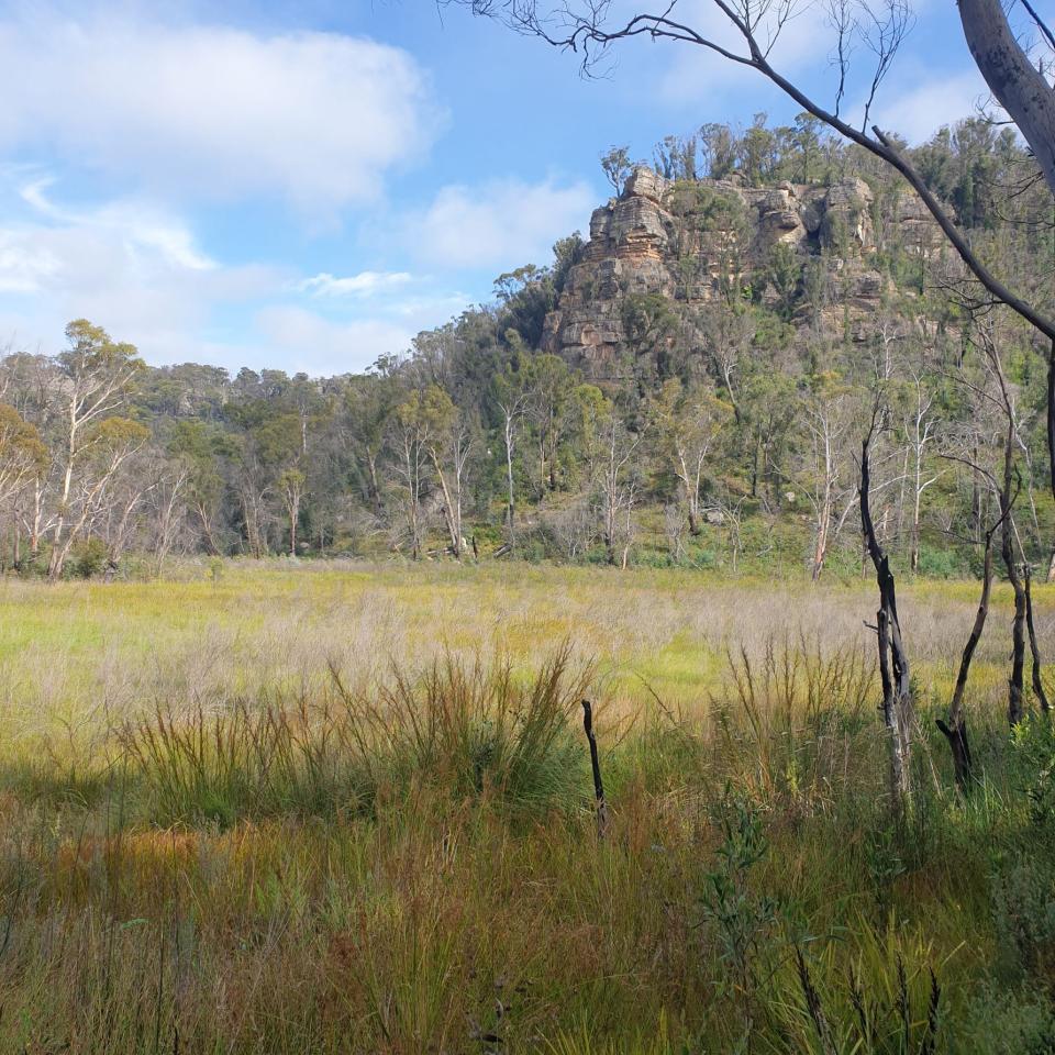
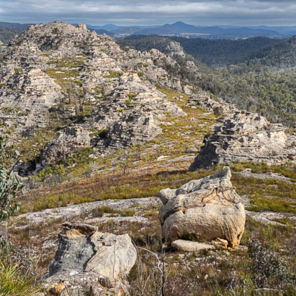
The Gardens of Stone State Conservation Area has been pulled back from the brink by dedicated public servants and volunteers. There are scars and you’ll see them, also fantastic NPWS restoration work, including removal of a 2,171ha pine forest, and new visitor management works. You’ll see the management challenges. Most of all you’ll be entranced by wonderful landscapes and occasionally disturbed by the coal industry. The State Conservation Area ain’t no wilderness, but its some of the best in the Mountains. If we’re to save the planet from climate disaster, the Gardens of Stone was good place to start. Perhaps you’ll even find an answer to that thorny question - why wilderness?
Fit, competent walkers can do this walk in four days, but five days should be allowed for scrub, navigational errors, challenges and discoveries. Many parties will take six days.
Basic trip outline – (refer to detailed trip notes for navigation)
Day 1: Arrive Bell Station on an early train, exit and follow Sandham Road a kilometre north-west. Just past the village a NPWS sign indicates the Bell Perimeter fire road access to Blue Mountains National Park. From there head to a large pagoda at spot height 994m. Then follow a pad north across the Wollangambe River and continue north to eventually join the Wollangambe management road. You then must find and follow revegetating 4WD roads to spot height 1032m then its off-track down a spur to Bungleborri Creek which is good going. Ascending a spur opposite you’ll then join up with a road through a dramatic pagoda landscape. It’s then a simple task to walk to Dingo Creek and find a nice camp, after getting water at the creek crossing.
Day 2: This day is about crossing Carne Creek and reaching the Wolgan River. Take care to locate Fire Road number 4 after Carne Creek and to turn right onto Sunnyside Ridge Road for 400m to pick up a minor management road on the left that heads west about 50m before the Birds Rock turnoff. The going is tricky as you approach spot height 1134m as the route disappears into the scrub. Stay on the top of the ridge! Eventually you’ll pick up the old revegetating 4WD road that will become apparent when you descend a spur to the Wolgan River, where its possible to camp.
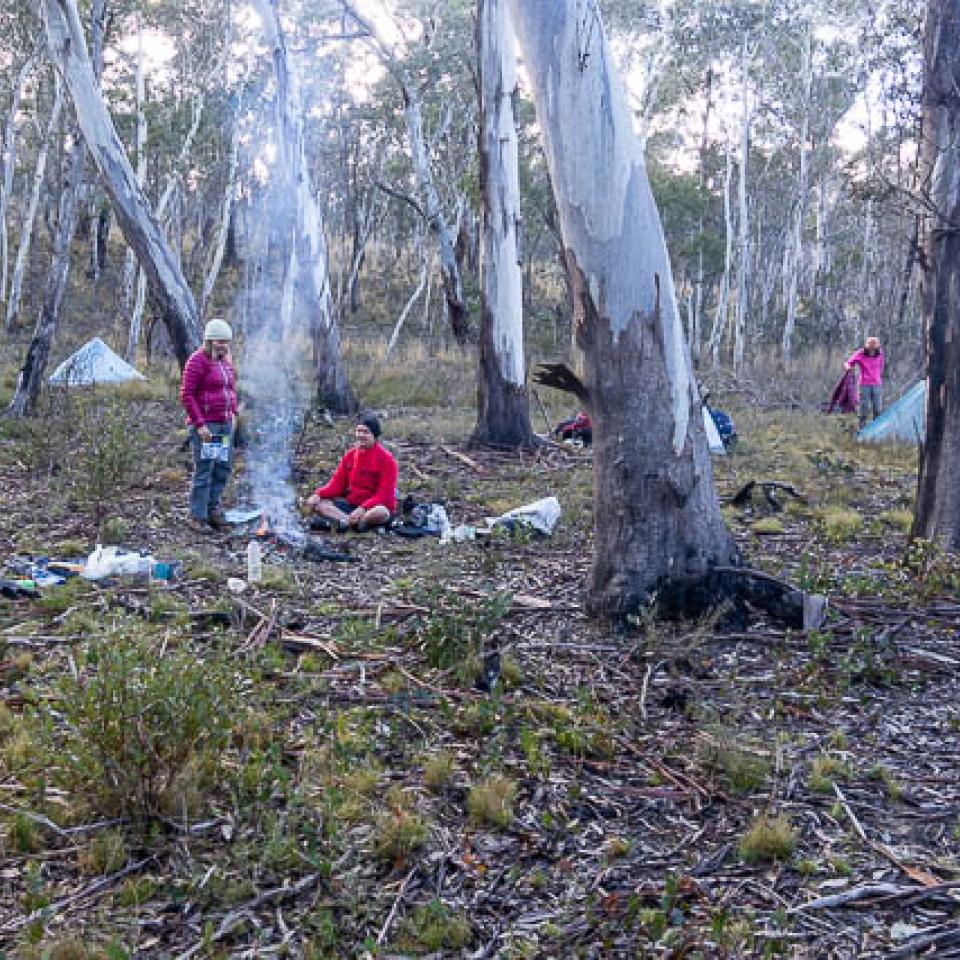
Day 3: A convenient log enables you to cross the river. Then traverse the base of the hill north to pick up a former trail bike track up the ridge. Follow the trip notes carefully and the route to find your way to No 5 Fire Road and then uphill to Hands Road where you turn right and walk 700m then turn left onto a closed road. Follow this revegetating road and then a former trail bike track to Lambs Creek and then 300m off track over fallen timber to cross at a creek junction. After 150m downstream on the true left bank, head up a prominent gully to the south, which follows a badly eroded bike track to the saddle. Then descend to Kangaroo Creek, locate a former bike track that leads to a fallen tree crossing the creek. Get enough water at Kangaroo Creek for camp and the next morning. After crossing the creek walk down the closed management road for 2km and ascend by a gully as mentioned in the trip notes. There are potential camp sites in the exit gully and on the Plateau above.
Pagoda spire on pass between Kangaroo and Lambs Creeks
Kangaroo Creek swamp
Camp on upper Kangaroo Creek, no permanent water (Photo: D. Noble)
Day 4: Follow the closed management road, go left onto Angus Place Road and left onto Beecroft Road and left again down Kangaroos Creek Road and cross the creek line. Immediately on your right is a former trail bike track. Follow this track for 1.3km, and then go southeast offtrack crossing the creek line and aim to intersect a former fire road heading southeast. Follow this former road, cross the Beecroft Road and a 66kV power easement to reach the management road heading south towards Lost City. Descend to Marrangaroo Creek and head east upstream by a heavily overgrown former road to reach the new Lost City walking track. Follow this track, then the Lost City access road to State Mine Gully Road. Cross this road and head south for 1.2km and then east for 1.2km and south again for 1.3km to descend into Farmers Creek and camp there or on the previous ridge above the creek.
Ridge above Marrangaroo Creek (Photo: D. Noble)
Day 5: Stroll down Farmers Creek to either Zig Zag or Lithgow Station.