Visit and learn about the magnificent Gardens of Stone region on the western side of the Blue Mountains and easily accessible from Sydney or the Central West. The Gardens of Stone Visitors Map shows trails, views and other main attractions.
Only two hours drive from Sydney, the Gardens of Stone offer many family adventures from picnicking and sightseeing to day walks, camping, nature study, exploring industrial ruins, bird-watching, bicycling, photography, drawing and painting. The Visitors Map, although published before the creation of the reserve, covers the entire Gardens of Stone region at a 1:100,000 scale, making it ideal for planning your next trip to the area.
There are lots of opportunities for multi-day walks, rock climbing, abseiling and cannoning. Accommodation is readily available in Lithgow and other nearby towns. Don't forget to check NPWS alerts for the Gardens of Stone SCA before you head out.
Walks on the Newnes Plateau
Three short out and back walks
Temple of Doom - short and moderate walking
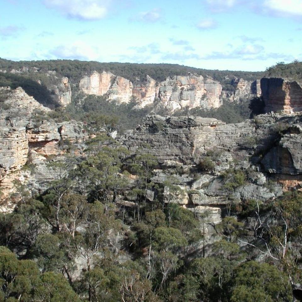
1:25,000 Map: Cullen Bullen

A short moderate walk for views of forest, pagodas and cliffs.
Drive north-east on Maiyingu Marrago Road (Hands Road) from Bungleboori Picnic Area for approx. 12km to where the road heads west and drops steeply off the plateau (MGA-330,088; 56H 233267E 6308849N), and then walk 300m north from the road on a rough track. Temple of Doom is on the centreline of a ridge between two gullies. Return the way you came.
Wolgan Gorge - offtrack, requires navigation skills, but flat
1:25,000 Cullen Bullen map
A moderately challenging short walk for visitors, but basic bush navigation skills are required - (stay on top of the ridge!)
Drive north-east on Maiyingu Marrago Road (Hands Road) from Bungleboori Picnic Area for approx. 11km, turn right off the Blackfellows Hand Road at Fire Trail No. 5. Park near the locked gate. Leave the rough 4WD road at about 400m past the gate (MGA-351, 094 Co-ord 56H 235090E 6309464N). Navigation skills are needed to get near the falls (approximately 1.5km offtrack heading due north) where there are great views over pagoda formations, Wolgan Gorge and glimpses of the falls.
Lurline Jack Lookout - mod. easy, on an eroded former 4WD road
1:25,000 Cullen Bullen map

An easy walk with views of cliffs, pagodas and heathland.
Turn left off Glowworm Tunned Road at Fire Road No. 2 about 10km north of Bungleboori Picnic Area (MGA-440, 082; Co-ords 56H 243983E 6308159N) and park.
Then walk along rough 4WD rock to end of road, about 2km and 100m downhill. Then return. Warning, no guard railing, not for young children.
Longer Walks
The longer walks in the Gardens of Stone State Conservation Area are magnificent but also challenging.
Anyone attempting these should have navigation skills and equipment for remote walking, such as a EPIRB or PLB.
The State Conservation Area connects with a number of major national parks, allowing for a number of epic multi-day walking routes through the region.
The NPWS is building a multi-day walk, but meanwhile if you are skilled at navigation and route finding, you can discover some many amazing features of the area.